
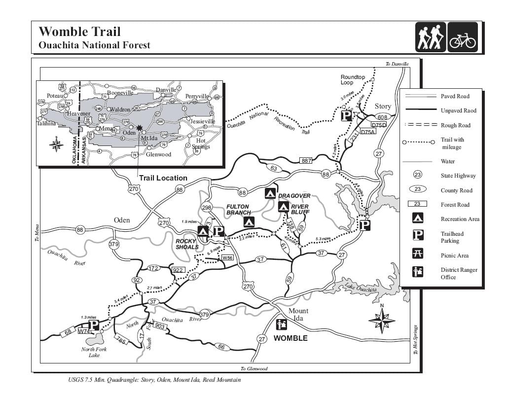
Maps of the OT
Click here for detailed maps and elevation profiles from the Ouachita Mountain Hikers website.
Click here for some great topo maps.
The FarOut App has guides to the Ouachita Trail 
Click Here for the FarOut map of the Ouachita Trail
The FarOut app is the leading mobile navigational guide for long-distance trails like the Ouachita Trail. Designed for offline use, the app shows your precise location on the map and provides detailed information about key resources along the route, including water sources, shelters, trail junctions, and road crossings. Whether you’re out for a section hike or tackling the entire trail, FarOut helps you navigate with confidence.
OT Overview Map
Trail Guide
For detailed information and maps on the Ouachita Trail refer to FoOT’s official guide: “Ouachita Trail Guide” by Tim Ernst. The book is available at some Arkansas State Parks, Ouachita National Forest Ranger Stations serving the Ouachita Trail, or from the publisher’s online store at TimErnst.com.
FoOT members get a discount when ordering from the publisher!

Ouachita Trail Guide by Tim Ernst